nCa Report
Amudarya, the most famous river of Central Asia, is not a single river – It is an integrated river system spanning six, possibly seven countries.
Amudarya is usually written as Amudarya River, which is superfluous because ‘darya’ in Amudarya means river.
This river has always caught the imagination of the travellers and authors. In various languages and during the various periods, it has also been called Oxus, Vaksu, Chaksu, Yakhsha, Wehrod, də Āmu Sind, Jeihun (Jaihun), etc.
The name Amu is derived from the ancient fortress city Amul, which is located in the current-day Turkmenabat of Turkmenistan. The ruins of this historic city have largely been discovered by the archaeologists of Turkmenistan.
In 2018, the foreign office of Turkmenistan, together with the ministry of culture, organized a trip for the journalists to the part of the ancient Silk Road that passed through the territory of Turkmenistan. The starting point was the Amul city, which was also the starting point for the caravans traveling west because of its security and logistics facilities.
The nCa team comprising of Tariq Saeedi, Raviliya Kadyrova and Elvira Kadyrova was among the journalists invited for the trip. We published a detailed report on Amul. It can be found at the following links:
Journalists feel the Heart of the Great Silk Road – Part 1
Tariq Saeedi, Raviliya Kadyrova, Elvira Kadyrova
https://www.newscentralasia.net/2018/06/29/journalists-feel-the-heart-of-the-great-silk-road-part-1/
Journalists feel the Heart of the Great Silk Road – Part 2
Tariq Saeedi, Raviliya Kadyrova, Elvira Kadyrova
https://www.newscentralasia.net/2018/07/02/journalists-feel-the-heart-of-the-great-silk-road-part-2/
Journalists feel the Heart of the Great Silk Road – Part 3
Tariq Saeedi, Raviliya Kadyrova, Elvira Kadyrova
https://www.newscentralasia.net/2018/07/10/journalists-feel-the-heart-of-the-great-silk-road-part-3/
* * *
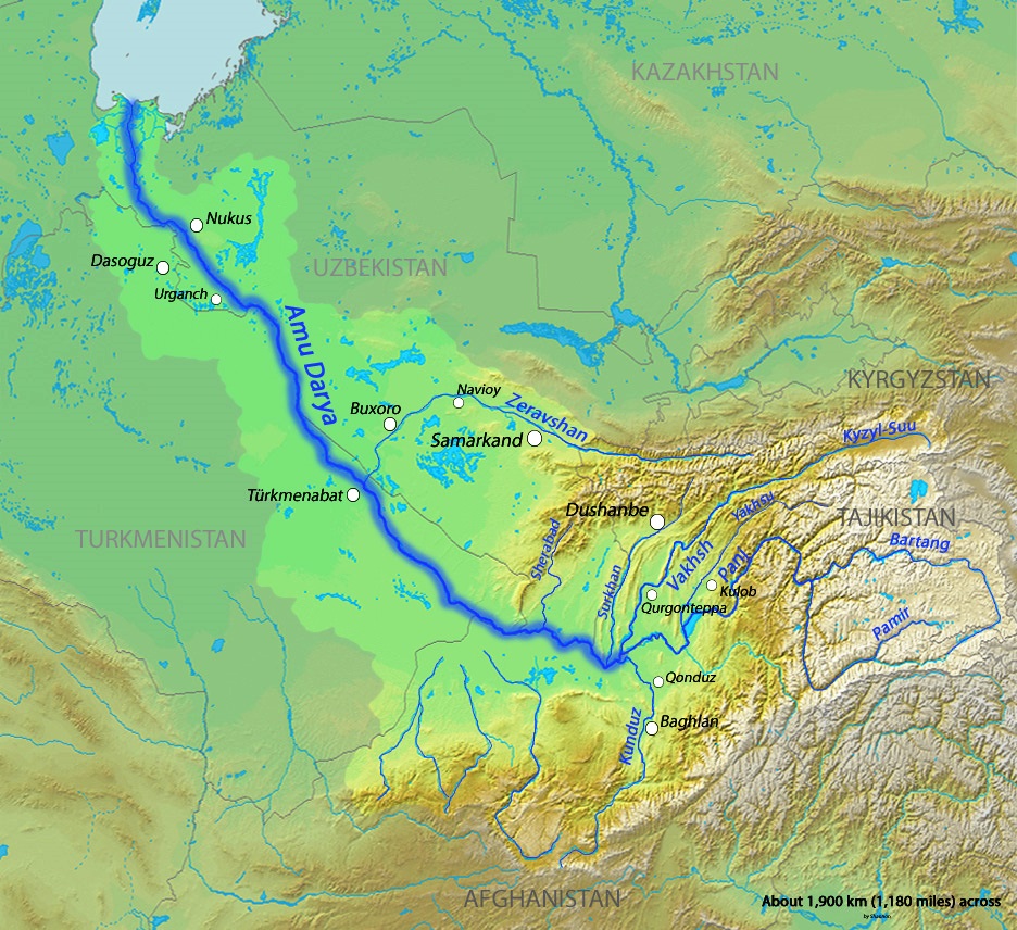
Amu is not a single river. It is an integrated, complex river system, spanning six, possibly seven countries. It is a shared water resource in every sense of the word.
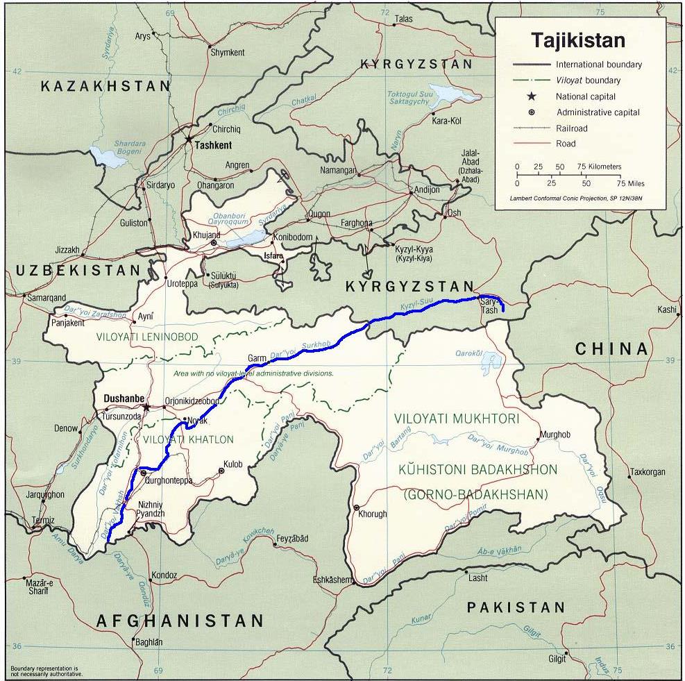
The river is formed by the confluence of the Vakhsh and Panj (Pyanj) rivers in the Tigrovaya Balka Nature Reserve on the border between Afghanistan and Tajikistan.
It meanders through a tortuous route to end in or near the Aral Sea.
It also serves as part of the borders of Afghanistan with Tajikistan, Uzbekistan, and Turkmenistan.
The Amudarya has an average flow of about 70-90 cubic kilometres a year.
According to a paper compiled by Daene C. McKinney (fourth edit 18 November 2003) – “Cooperative management of transboundary water resources in Central Asia” – the river’s total length is 2,400 kilometres (1,500 mi) and its drainage basin totals 534,739 square kilometres (206,464 sq mi) in area, providing a mean discharge of around 97.4 cubic kilometres (23.4 cu mi) of water per year. The river is navigable for over 1,450 kilometres (900 mi). All of the water comes from the high mountains in the south where annual precipitation can be over 1,000 mm (39 in). Even before large-scale irrigation began, high summer evaporation meant that not all of this discharge reached the Aral Sea – though there is some evidence the large Pamir glaciers provided enough meltwater for the Aral to overflow during the 13th and 14th centuries.
Link to McKinney report
https://www.caee.utexas.edu/prof/mckinney/papers/aral/CentralAsiaWater-McKinney.pdf
According to several sources including ‘Expedition Report’ by Mock, J. and O’Neil, K. (2004), and ‘Halfway House to Heaven’ by Colegrave, Bill (2011), there are four different claimants as the true source of the Amu:
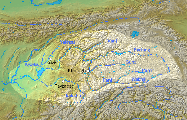
- The Pamir River, which emerges from Lake Zorkul (once also known as Lake Victoria) in the Pamir Mountains (ancient Mount Imeon), and flows west to Qila-e Panja, where it joins the Wakhan River to form the Panj River.
- The Sarhad or Little Pamir River flowing down the Little Pamir in the High Wakhan
- Lake Chamaktin, which discharges to the east into the Aksu River, which in turn becomes the Murghab and then Bartang rivers, and which eventually joins the Panj Oxus branch 350 kilometres downstream at Roshan Vomar in Tajikistan.
- An ice cave at the end of the Wakhjir valley, in the Wakhan Corridor, in the Pamir Mountains, near the border with Pakistan.
A Wikipedia entry says that the 534,769 square kilometres (206,475 sq mi) of the Amu Darya drainage basin include most of Tajikistan, the southwest corner of Kyrgyzstan, the northeast corner of Afghanistan, a narrow portion of eastern Turkmenistan and the western half of Uzbekistan.
The summary of the Interstate Coordination Water Commission report (http://www.icwc-aral.uz/bwoamu.htm) (https://web.archive.org/web/20040618150720/http://www.icwc-aral.uz/bwoamu.htm) says:
Amudarya River basin covers total territory of Turkmenistan and part of Tajikistan and Uzbekistan, Kyrgyzstan and Afghanistan.
Amudarya is the largest river in catchment area and water availability in Central Asia and is formed by Pyandj (Panj) and Vakhsh rivers conjunction. Its total length from Pyandj River head to Aral Sea is 2574 km, from conjunction place 1415 km.
Pyandj River almost along all length passes border between Tajikistan and Afghanistan.
Amudarya River receives tributaries only within first 180 km. Within 12 km from Pyandj and Vakhsh conjunction place Kunduz River (Afganistan) inflows from the left, within 38 km from the right Kafirnigan River, within 137 km Surkhandarya River, within 180 km Sherabad River.
Amudarya River basin is the largest in area and water availability in this region.
Amudarya belongs to rivers with glacier-snow inflow, area of glaciers on right-bank water catchment areas is 7.3 thousands km2. Water catchment area is 226.8 thousands km2.
* * *
The Convention on the Protection and Use of Transboundary Watercourses and International Lakes (Water Convention) was adopted in 1992. It is a unique United Nations treaty to support transboundary water cooperation worldwide.
Shared management of cross-border rivers, lakes and groundwater is crucial to avert looming water crises, stress UN and countries after 30-year success of Water Convention
https://unece.org/media/press/368948
With 153 countries sharing the transboundary rivers, lakes, and groundwater reserves that make up more than 60% of the world’s freshwater flow, the fundamental role of transboundary water cooperation for peace and sustainable development has been reaffirmed both at global and regional level, including in the Sustainable Development Goals (SDGs), by the UN Security Council, in the African Ministers’ Council on Water Strategy 2018-2030, and in the EU Council Conclusions on Water in EU External Action adopted in 2021.
* * *
The International Water Association defines three principles for Integrated Water Resources Management (IWRM):
– How will my decision / action affect access for other users to water or the benefits from its use?
– Will my decision / action result in the ‘most efficient use of the available financial & water resources?
– How will my decision / action affect the functioning of natural systems?
Integrated Water Resources Management: Basic Concepts
https://www.iwapublishing.com/news/integrated-water-resources-management-basic-concepts
* * *
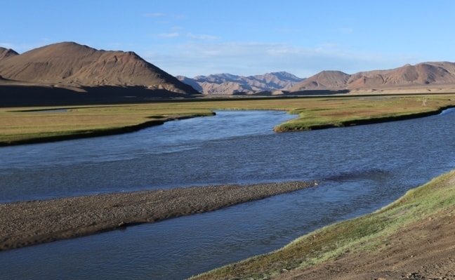
Amu River
Vakhsh River
Panj River
/// nCa, 11 March 2024 [Images from Wikipedia]


