Elena Dolgova
Despite its location in the arid zone, Turkmenistan is rich in hydrological natural monuments. Some are the result of the development of the earth’s crust – these are volcanoes, thermal and mineral springs, others are evidence of the abundance of water in the distant past and the accumulation of flood waters for many thousands of years – springs, rivers with waterfalls, relict and karst lakes in the caves of the Kapkutan system in Lebap. They have their own hydrological network and regime.
It is interesting to note that thermal and mineral waters have been the most popular hydrological monuments in Turkmenistan since ancient times for their therapeutic uses. The quality of the spring waters and the healing properties of the mud are comparable to those found in popular resorts and hospitals around the world.
The hydrological monuments of Turkmenistan are diverse and cater to a wide range of activities, including automobile travel, horseback riding, water sports, hiking, and serene relaxation in the natural environment. This is especially valuable in a hot climate.
The most amazing are the relict drainless freshwater reservoirs in the Karakum desert. A blue mirage among golden heated dunes occupied the minds, imagination and excited people. The answer was provided by geology – the lakes are located 50 meters below sea level and fed by groundwater.
The waters of the Cheleken Peninsula abound with chloride-sodium-calcium brines and iodine-bromine waters. The hot salt water from the well located south of the city of Balkanabat has a very high iodine content.
Chloride-sulfate-magnesium-sodium waters from self-draining wells located near the village of Farab are close to the mineral waters of Truskavets and Feodosia.
The unique hot chloride-magnesium-calcium waters of the well located north of the city of Bayramali are similar in composition to the waters of “Chartak” and the physiotherapy clinic in Southern Alamyshik in Uzbekistan.
The mud of the Uzboy and Farab lakes are comparable with the medicinal muds of the Crimea.
The healing properties of these areas have been long known to people, as evidenced by the parables, tales, fairy tales, and legends that have come down to us, recorded thanks to the painstaking work of folklorists and local historians.
Many legends are connected with the tragic affection of lovers to each other. For example, another thermal spring is associated with the “blood” of an innocently deceased lover, and drops of Damdam waterfall (from Turkm. “damja” – “drop”) is interpreted as tears of separated young people, etc.
The nature of Turkmenistan has vast balneological riches and has presented such outlandish thermal springs as Archman (Akhal), Parkhay, Ovezbaba and the subthermal spring of Ejeri (Balkan), Khojakaynar (Lebap), etc. The people tried to explain their magical healing nature with beautiful legends.
There are stories about the emergence of an underground lake with hydrogen sulfide water Kov-ata in Akhal, associated with the construction of deep wells, kyariz, which for decades served as a source of clean spring water for locals. They knew how to bring the water to the plain from underground reserves contained in the bowels of the rocky foothills, as well as sardob and water-filling complex wells “chirle” in Karakum desert. In these cunningly arranged mines in the depression, water was drained from the catchments at high water and filtered out.
There are many proverbs about water – the source of life in the desert. Water is revered as the “father” of the harvest, the “soul” of the field, compared to a grain of gold: “without water there is no life, without labor there is no prosperity”, “the beauty of the desert is water”, etc.
Locals believe in the magical power of natural water monuments and visit them willingly. Ethnographers appreciate their cultural and aesthetic significance, as well as the unusual genesis and centuries-old persistence of these beliefs, which contributes to the preservation and respect for these places. Sometimes, such sacred places become a destination for mass pilgrimage, where people come to connect with the beauty of the natural world, find peace and quiet, and escape the hustle and bustle of everyday life. They strive for spiritual purification, renewal, and enrichment.
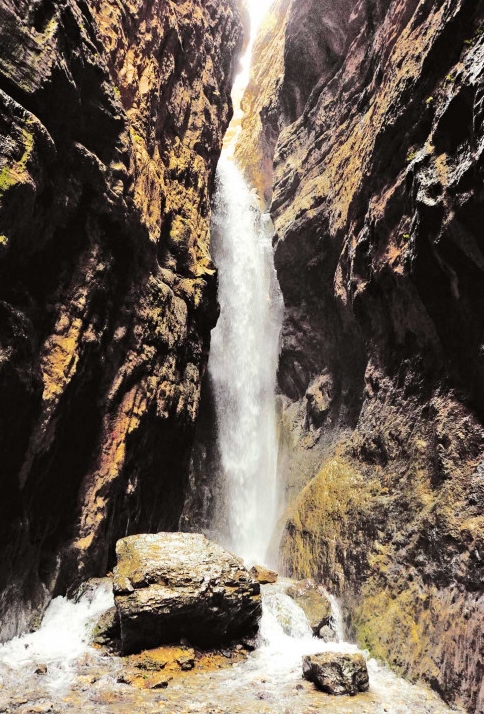
According to a legend, the Umbar-dere waterfall in the Lebap province was formed when a brave young man jumped over a deep gorge to escape capture. Tourists are amazed by its beauty, coolness, and pure air, as well as the taste of its natural water. Pilgrims often plant trees and take care of the cleanliness of the area, as is the case near the Kirkgyz waterfall near the village of Murcha in the Baherden district. There is also a place for visitors to relax, with beds, dishes, and a place to cook hot food.
Specifically, the hydrological monuments of nature are associated with the most valuable natural wealth for Turkmenistan – fresh drinking, mineral or thermal water.
Remoteness from large cities, isolation creates an atmosphere of tranquility, which is necessary for high-quality rehabilitation, treatment and recovery, sets patients up for recovery and the peaceful landscape of the Karakum, clean air, environmental friendliness. The nature itself heals, man only directs nature’s hand.
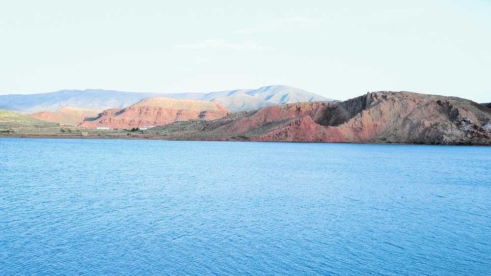
Among the hydrological man–made monuments of Turkmenistan are the system of collectors and the huge volume of waters of the Turkmen lake “Altyn asyr”. Its construction began in 2000 and still underway. For the storage of significant water reserves, there is a natural Karashor depression located in the immediate vicinity of the reservoir currently being formed, the capacity of which exceeds 130 cubic kilometers.
The depression is 25 meters below the sea level, its length is more than 100 km, its width exceeds 12 km in some areas. In short, the capacity of the Karashor is limitless, capable of accepting a huge volume of water for storage and use in the future for the benefit of man.
The newly created water body is already being used by migratory birds, and has formed a biota of fish and aquatic plants. It contributes to the enrichment of the species composition of the flora and fauna, improves the environmental situation of the adjacent territory, and is of interest for economic and industrial use (a modern village of livestock breeders is already being built here). It can also serve as a landfill for water tourism lovers.
An amazing natural monument is the cascading Koshtemir waterfall in Southwestern Kopetdag – a popular place for tourists, weekend routes, or during vacations, in a word, active recreation. The width of the water stream at the bottom of its first cascade is 50 meters, the height is 15 meters. After about one and a half kilometers , there is a second cascade with a height of 5 meters and a stream width of up to 20 meters. The remaining cascades are smaller, with a narrow watercourse, since the flow rate of the springs feeding the waterfall decreases with the climb. Here, on the ledges of the mountains, you can see mountain partridges, rock pigeons, jackdaws and other birds, and in the secluded crevices and shallow hollows facing the Koshtemir riverbed, century-old fruit-bearing walnut trees can be found.
The accumulated waters of the Yeroylanduz depression are a watering place for animals, and this lakey is not used by humans, since this wonderful place is located in the southern part of the Badkhyz State Nature Reserve. However, The depression is a popular destination for scientific tourism, as well as for photographers, TV crews, and cinematographers. The stunning scenery is best appreciated at sunset, when the setting sun reflects off the mica layers around the salt lakes, and the pyramids of long-extinct volcanoes cast their shadows on the calm waters. The landscape of Yeroylanduz is truly unearthly.
The beauty of these places is worthy of the artist’s brush, also the drainless depression has an interesting geological history. In the Jurassic era there was a plain, in the Cretaceous period a sea with lagoons formed in its place, and in the Paleogene land was formed again. The fossils of organisms of prehistoric time can be found there almost on the surface. The shells of ostrich eggs, fragments of skeletons of small mammals and lizards, ancient flora, the elytra of an unknown beetle from Upper Eocene deposits were found there.
The Yeroylanduz depression is a vast depression in Turkmenistan, with a height of up to 400-500 meters and an ellipsoidal shape that stretches for more than 20 kilometers from east to west. The northern slope is a wall of cliffs and steep slopes, while the southern slope is gentle. The center of the depression is occupied by the Eastern Namaksar salt marsh, which is connected to a temporary lake by a salty ditch. The lake forms during spring rains and then gradually dries up. At the bottom of the depression, there is a picturesque group of remnant hills, most of which are composed of volcanic rocks. ///Originally published in the newspaper “Neutral Turkmenistan”, 30 August 2023
#Water, #water_resources_in_Turkmenistan, #Turkmenistan, #lakes, #environment


